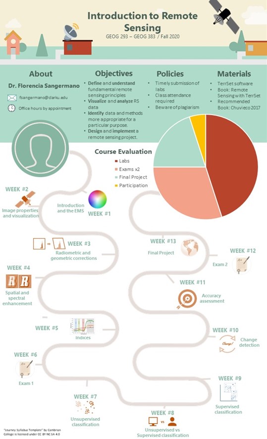
Introduction to Remote Sensing
This course introduces students to the principles of satellite remote sensing. Methods and applications are focused on the use of digital satellite images (including Landsat, MODIS, SPOT, and AVHRR) for land cover classification, land use land cover change analysis, and other topics. The course consists of two lectures and one lab session per week. Lectures are aimed to present the theoretical principles and methodologies, while labs are designed to apply the concepts using an Image Processing Software. The lectures and labs will cover all aspects needed to perform an independent remote sensing project, with topics including image acquisition, pre-processing, image classification and change detection.
After the successful completion of the course, students should:
- Have a strong conceptual understanding of fundamental remote sensing principles
- Have the ability to convey in written and verbal format RS concepts, methods, applications
- Have the ability to use remote sensing tools to answer research questions
Prerequisites: IDCE310/GEOG 190/ID190 or equivalent background
Overview of syllabus
Click HERE for an example of a class final project