Introduction to Geographic Information Systems
This course introduces the discipline of Geographic Information Science (GIS). During the course of study, students learn the theory and applications of raster and vector based GIS, through a combination of lectures, demonstrations and laboratory exercises. The class uses both the IDRISI/Terrset software developed by Clark Labs and the ArcGIS software developed by Environmental Systems Research Institute (ESRI). Lectures are technical in nature and designed to provide an understanding of how data are created, stored and manipulated. A strong component of the course are lab sessions which are intended to apply the concepts learned during lectures. Weekly laboratory exercises and a final independent project will provide intensive hands-on exposure to GIS software. At the conclusion of this course, students will have the ability to independently develop, manage, and complete a GIS project.
The focus of the course is on analytical concepts that are fundamental for any spatial analysis using any GIS software. The objectives of the course are:
– To understand basic theoretical concepts of GIS and spatial analysis
– To learn the operation of two GIS software packages (e.g. students will be able to use these GIS software packages to organize, query, manipulate, analyze, and present spatial data)
– To formulate a research question, lay out and implement analytical steps required in GIS environment
Course Syllabus: GEOG190-IDCE310_Introduction_to_GIS_Syllabus_S2019
Some Final Project Examples:
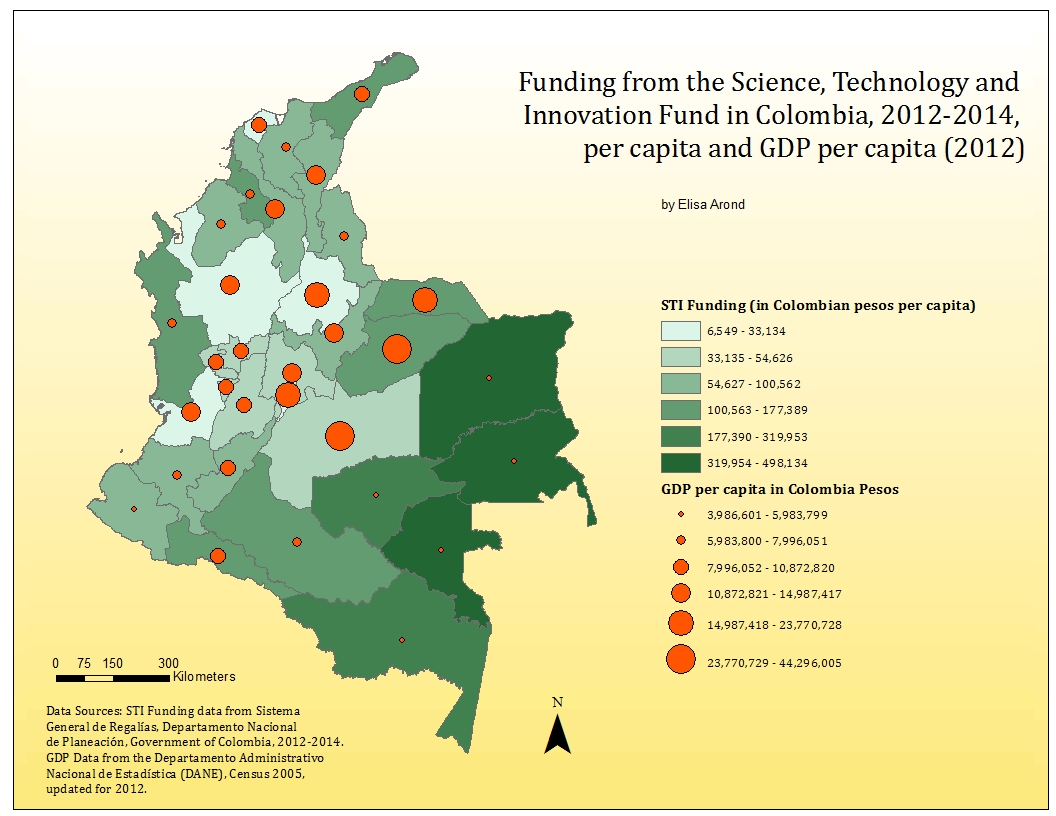
Elisa Arond: The Regionalization of Science, Technology and Innovation in Colombia through the National System of Royalties Fund 2012-2013
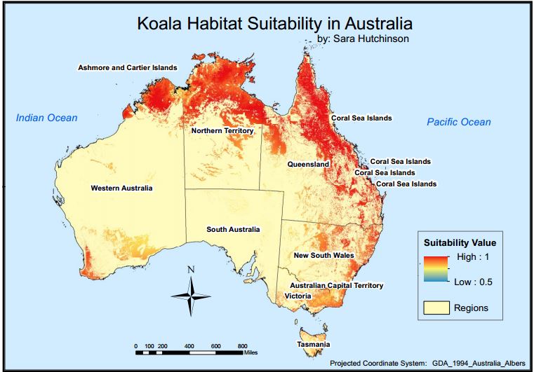
Sara Hutchinson: Using Geospatial Analysis to Map Habitat Suitability for Koalas

Erin Barta: Home Sweet Home: Apartment Suitability Maps