This is the link to my Map CUP, which was a history unit on maps. This was the first complete unit that I taught. I am proud of this unit, but I have also learned so much since I have taught it.
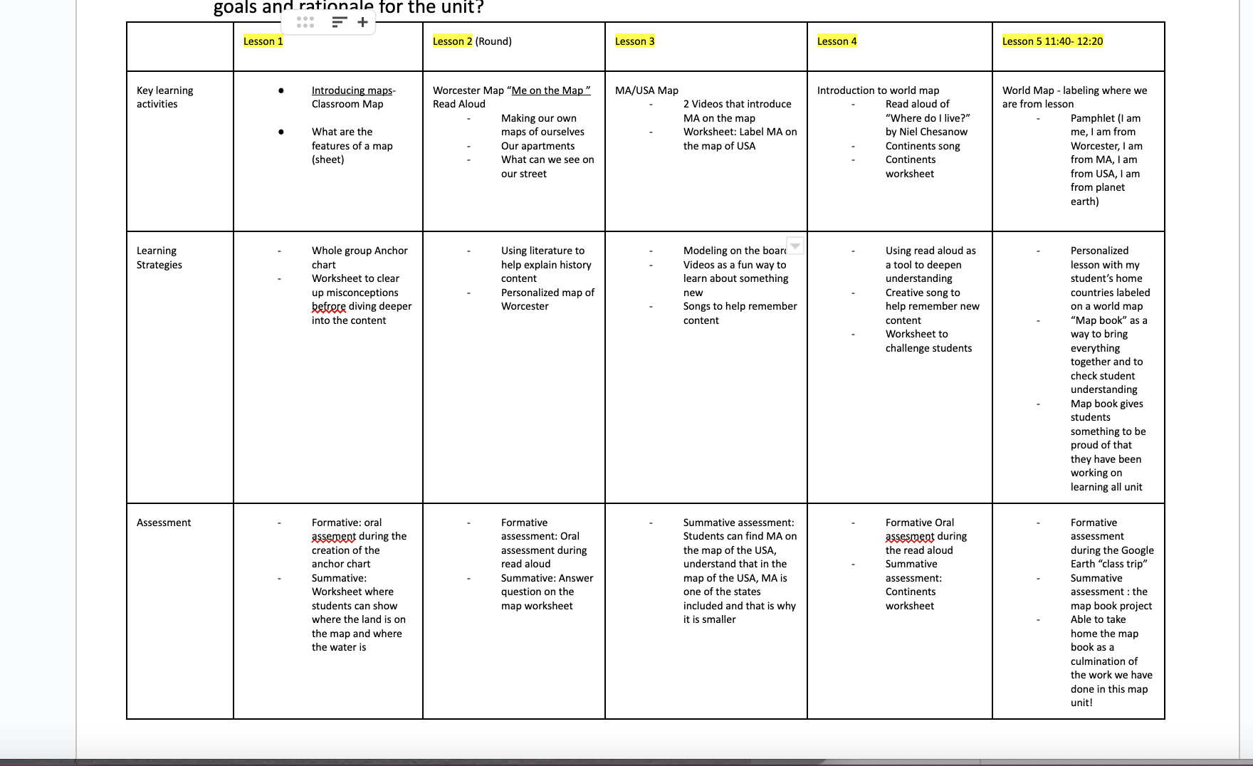
Lesson 1: We talked about what we have heard about maps and made a collective anchor chart of everything the students knew already. We wrapped up by talking about how land and water can be represented on a map.
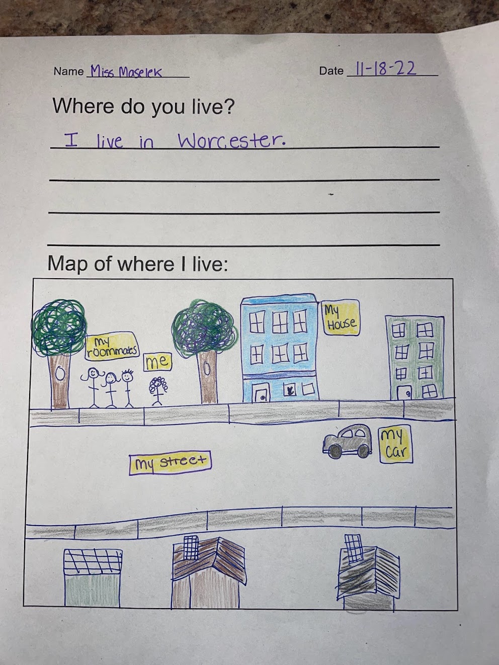
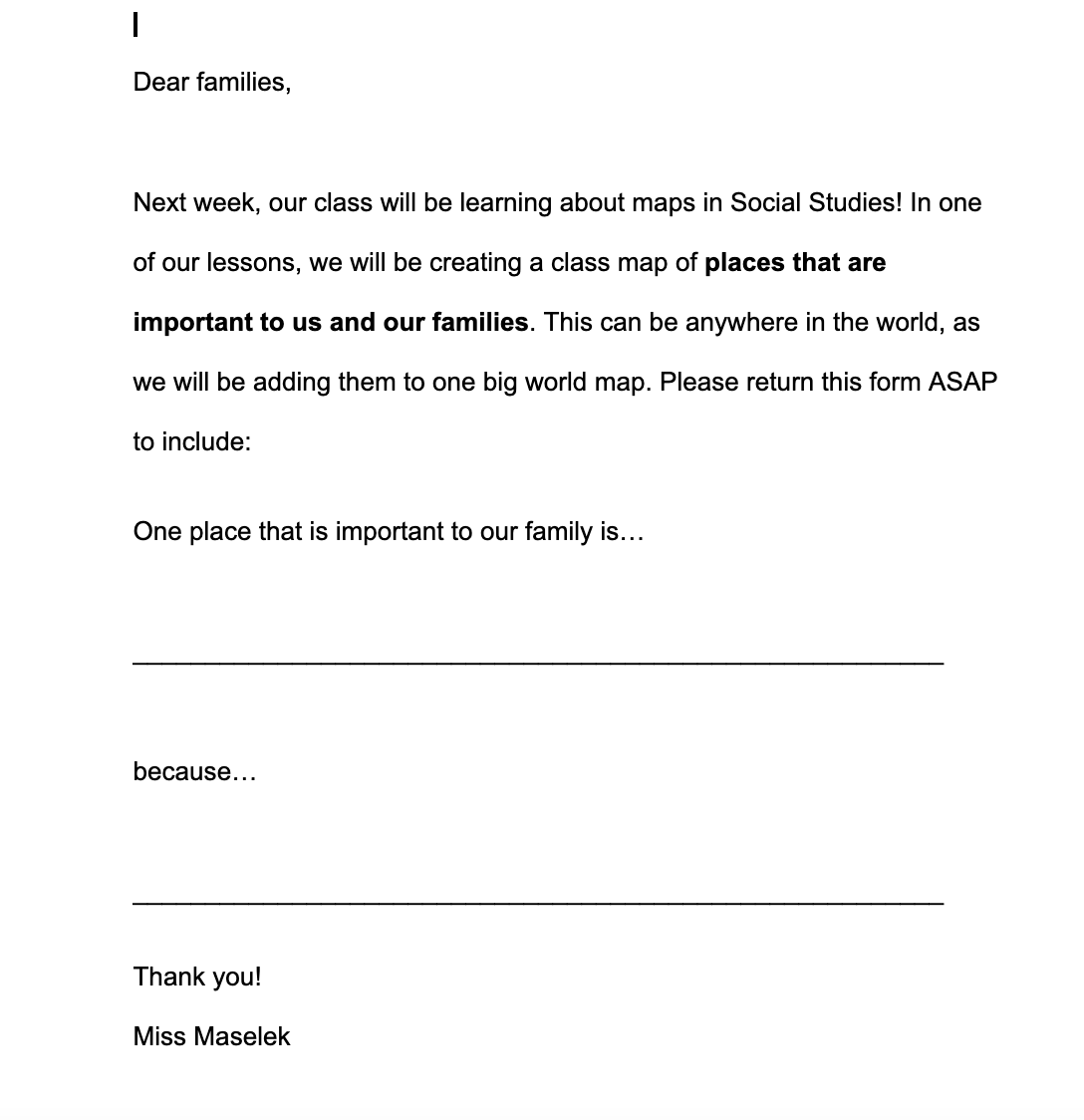
Lesson 2: We read “Me on the Map” by John Sweeney and then we made our own maps of where we live in Worcester.
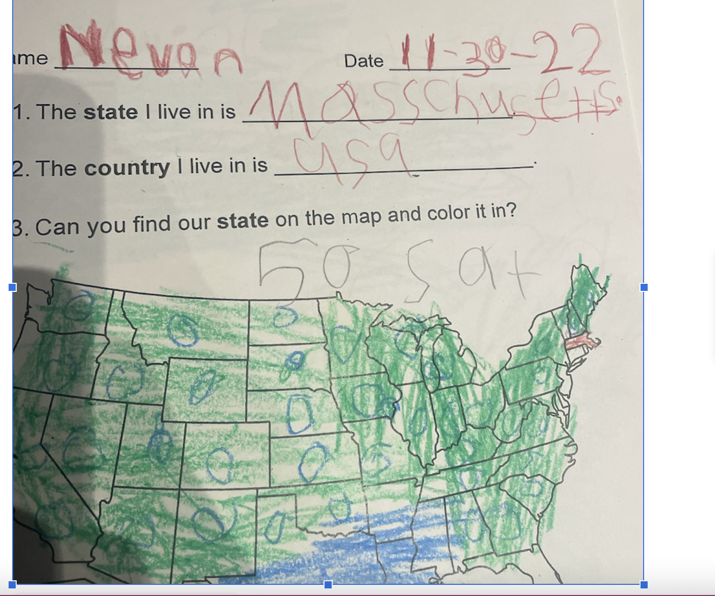
Lesson 3: We learned more about how we live in MA, and how one state fits into the whole country. Students also worked on finding MA on a map of the USA.
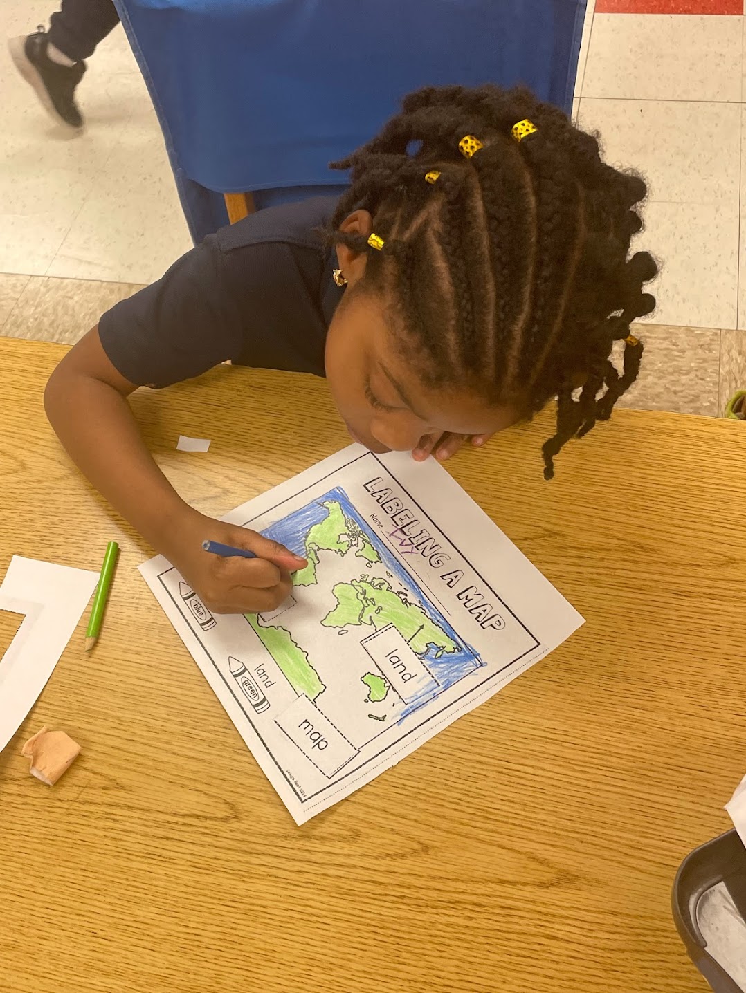
Lesson 4: We read “Where do I Live?” and filled in a blank map of the continents.
Lesson 5: Our class went on a Google Earth trip around the world and zoomed into places that meant something to students in the class. We discussed what looked different in each country and city (was there water, big buildings, etc.).
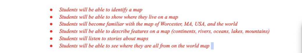
- Students met my learning goals, and we explored so many different maps together. Found below, is student work from our third lesson, where students found our state on the map. Not only did students learn about maps, but students also learned about what state we lived in, and what country we live in. It is so important to start learning about this early on.
- Through this unit, I was able to plan a lesson that highlighted my student’s home countries and places that meant something to them. We used Google Earth to take time zooming in on the map of the earth into different places. We zoomed into; the Dominican Republic, Ghana, Republic of the Congo, Florida, Spain, Brazil, Jamaica, and more. My students were able to see that different places look different on the map. My students were so happy to see “themselves” on the map. This was a great lesson and my students were so excited by it.
-
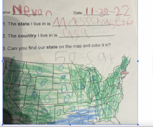
Map from lesson 3 where students found MA on the map of the USA. 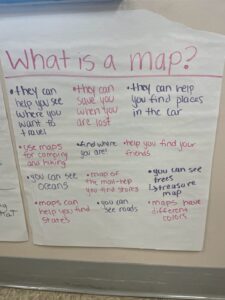
I asked the students to tell me anything they knew about a map to access prior knowledge before our unit. 
Here is the worksheet we did after lesson 1, where students could show me what they knew from coloring in the map and labeling the ocean and land. I was looking for students to tell me that maps can represent both land and water. - Attached here is a video from our read aloud, when we were talking about perspective and how maps can look different. I allowed students to share their perspective on maps, and opened up the discussion.
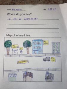
This my modeled example of the “map” each student created of their home. I was looking for students to tell me we lived in Worcester and show some details of their home. They really enjoyed this lesson because they got to do something creative, while also meeting the standard. 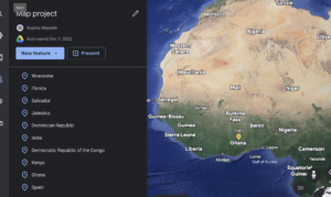
This is a snapshot of our “Google Earth trip” we went on to zoom into places that were important to members of our class. 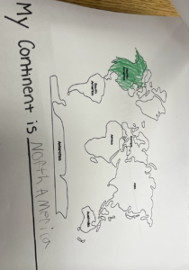
Here is a page of the map book we made after we did our “Google earth trip” for our last lesson. Students got to fill in the answers and also color in if they finished early. This was a way they could personalize the book and make it their own!